Police, medics, and firefighters are often called heroes because they are the people who run towards danger while the rest of us run away from it.
But while these heroes are out saving lives every day, they aren’t superheroes, meaning the risks they take to help others is real and dangerous. Whether it is running into a burning building, or engaging in a car chase to stop a dangerous driver, first responders put their lives at risk by taking on challenges that are often as terrifying as they are unpredictable.
But what if technology can be used to make emergency scenes less of an unknown? Or help medics deliver healthcare in locations that were previously hard to reach? The adoption of drone technology could mean that first responders no longer have to face such scenes blind.
Drones can capture an incident and provide details on it before the first responders arrive, and locate the danger so that the humans taking on these life-saving roles can still remain as safe as possible and perhaps get the job done quicker.
TI speaks to three drone specialists across police, fire and rescue, and medicine, about how they use drones to capture, provide, and prevent in the event of an emergency.
Police
When a car crashes, everything becomes urgent. The rescue operation. Medical treatments. And the capture of any evidence all need to be carried out at speed.
Officials can face huge pressures to get traffic flowing as quickly as possible – while maintaining safety levels. First responders only have so much time to use traditional methods, such as tape measures and cameras, to capture the scene as accurately as they can.
“At these scenes where there are lots of people, lots of debris, and lots of movement, these traditional methods are too slow and inefficient to make the scene investigator certain that they have documented every important piece of evidence,” tells Elmar Lenz, global vice president of survey solutions and public safety at Hexagon Geosystems.
New technologies including digital twins and and scanning drones, are transforming the way first responders deal with a crash scene. Swiss firm, Hexagon Geosystems, makes a variety of laser scanning and digital twin technology, including its autonomous drone BLK2FLY.
The drone can survey and document a scene, using laser scanning, much more efficiently and safely than a team of responders, particularly if there is a threat of fire.
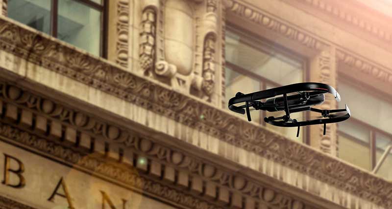
BLK2FLY in action
“Fire scenes are potentially even more difficult to capture with these methods; if there is a lot of smoke and falling debris, meaning the investigator has to wear full protective gear, there is only so long they can wear this cumbersome clothing to measure and capture the scene,” Lenz explains.
“In the same way that we moved away from the fax machine and the landline – tape measures, cameras, and sketchboards are becoming increasingly outdated in the face of laser scanners and digital twins.”
With the help of these technologies, public safety professionals can use a multi-dimensional reproduction of the collected evidence, accessible to all stakeholders to explore and study after the fact.
As BLK2FLY captures the scene in 3D, those who need it can model and spin it, exploring different angles, and will always have the scene in 3D as a digital file in order to revisit.
“The rework component is completely eliminated; this is the beauty of the forensic digital twin, you have all of the data at your fingertips so if you need to check the distance between car one or car two, you can do this at the touch of a button,” enthuses Lenz.
This “’Field to courtroom’ is another particularly exciting area for the public safety arena,” he adds. “The data from a crime scene can be taken and transformed into a visual and audible model, image, video, or written document, leveraging the point cloud, footage from the scene, and expert opinions, which is immediately accessible to a legal team, jury, or insurance company.”
Fire
While drones are useful as first responders in the event of a fire, they can also be used to prevent wildfires from happening, notably when they are caused by electricity wires coming into contact with branches of trees.
Finnish firm Sharper Shape uses autonomous drones to help build its living digital twins to help with the inspection of powerlines, any faults, and the growth of the trees around them.
“Increasing cases of wildfires are deeply concerning and a worrying indication of the serious impact of climate changes,” concerns Kristy McDermott, vice president of global sales at Sharper Shape. “Year-on-year, emergency response resources are called out to combat serious extreme weather scenarios – often exacerbated by arid conditions and poor vegetation management.”
Sharper Shape autonomous drone
Sharper Shape’s solution is to build a living digital twin that is easily updated using drones and handheld devices.
“Using advanced aerial inspection software and living digital twin technologies that can harness real-time meteorological data, we can now access powerful and proactive vegetation management SaaS solutions that could be virtual in the fight to prevent wildfires from becoming a serious risk,” McDermott explains.
The firm’s approach mixes drones, artificial intelligence, and sensors such as LiDAR, which accurately measure the height of terrain on the ground, and hyperspectral imaging to map out vegetation surrounding the powerlines to stop fires from happening.
“We believe that prevention can be the cure, and considering the strain which these events cause on emergency services and the damage to communities, it’s critical that we utilise latest technologies and strive to combat this growing threat,” concludes McDermott
Ambulance
UK-based social enterprise, Challenge Works, is an organisation aiming to inspire and motivate others to create solutions to help “solve the world’s biggest problems.”
Its Flying High initiative, in partnership with research firm Innovate UK, is a programme that assembles city leaders, regulators, public services, businesses and industry to push for the use of drones for good.
“Drones could be transformative for emergency medicines,” enthuses its head of Future Cities, Kathy Nothstine. “[They] could be used to rapidly deliver blood donations from blood banks to hospitals or direct to the scenes of accidents, bypassing busy roads in city centres.”
In Nothstine’s vision, drones could deliver specialist equipment to paramedics to minimise treatment delays for patients.
“Beyond emergency situations, they could transfer pathology samples to labs to improve turnaround times, and even be used to transfer donor organs to patients in need,” Nothstine sees.
Challenge Works has also partnered West Yorkshire Fire and Rescue Service to identify how drones could provide more information to support mission planners and controllers to direct the right resources when an emergency is identified.
“Drones can be deployed to survey a scene before the fire crew arrives so that they can assess the situation while they are en-route,” she explains.
Benefits of this include identifying false alarms, avoiding the need for costly helicopters, and improving the safety of firefighters and members of the public caught in fires.
“While much of this is technically possible, there are still regulatory challenges that need to be overcome to make the most of drones and for them to become an everyday part of life,” says Nothstine.
“Most use cases require drones to cover a lot of ground rapidly and with a degree of automation. That means having drones fly beyond the visual line of sight of an operator. Doing so safely at scale in a busy environment is still a major technical challenge and will need new regulations that accommodate the technology.”